Near-surface applied geophysics and advanced modeling techniques for soil compaction characterization
Soil compaction due to modern agricultural machinery is one of the major threats to global farmlands. Compaction, both in the surface or subsurface layers, adversely affects the soil structure, compromising its functions such as water and gas fluxes, and root growth, with dramatic economic loss for farmers due to reduction of crop production. Traditional indicators to assess soil compaction rely on point-scale or sample-scale analysis, omitting any evaluation of soil variability at a larger scale. Here a geophysics-based methodology, relying on applied electro-magnetic and seismic methods, is set-up to fill the gap between location-specific sample analysis and a larger scale soil compaction mapping that is relevant for land management.

The major contribution of the proposed methodology lays on the combination of different geophysical techniques, with a joint inversion approach of the acquired datasets that enable a detailed study of the soil structure. In particular, a representative pedophysical model that combines electrical and seismic geophysics-based measurements is applied in order to estimate the fractions of investigated soil constituents (air, water, and soil) and highlight the compaction phenomenon.
Measurements of soil electrical resistivity are usually conducted through Electrical Resistivity Tomography (ERT), a methodology that has proved its suitability for a range of tasks, such as delineation of soil horizons, estimation of soil water content and monitoring purposes.
In contrast, the use of seismic methods in soil science studies is not as common as for geotechnical and reservoir characterization. Seismic wave fields contain information about the mechanical properties of the subsurface and can offer more insights about soil compaction than other geophysical methods. Refraction Seismic Tomography, adopting appropriate frequencies and wavelengths, and exploring the application of surface waves may lead to major developments in soil compaction detection.
The combination of these two separate geophysical branches, targeted to highlight different physical properties leads to a more representative characterization of the soil structure, properties and dynamics.
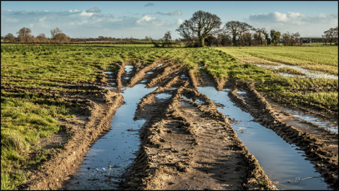
Soil compaction is a reduction in soil volume and a change in its structure, restricting water infiltration and gas exchange, and worsening water runoff and soil erosion. Compaction occurs when soil is subject to stresses that exceed its strength due to heavy agricultural machinery or the trampling of animals. Compaction of the topsoil has a significant impact on a range of soil ecosystem services including crop yield, but amelioration by tillage and natural processes are quite effective. Subsoil compaction, which occurs below the tillage layer, has also detrimental effects on soil functions, but it is particularly problematic as it is invisible, cumulative, and persistent.
Monitoring of soil physical properties is essential to prevent compaction. Traditional characterization methods rely on point values and snapshots in time, such as measurements of penetration resistance or dry bulk density. These techniques are widely used and give a precise quantification of the degree of compaction. However, they suffer from poor representativeness of the natural soil variability, being restricted to a narrow area that can only be partially translated into a state-of-the-soil mapping. Moreover, efforts of analysis increase when different depths are investigated, or when soil heterogeneity makes it necessary to increase the sample number.
To better characterize the state of the soil structure in space and time, and manage at best the field agricultural activities, innovative tools are required.
Applied geophysics provides a description of the investigated domain through measuring, analyzing, and interpreting physical property variations from its surface by proximal sensors in an undisturbed way. Geophysical methods originate from mineral and oil exploration and have long been exploited in geological and engineering surveys. Growth in their use expanded in hydrology in the 1990s, and more recently they are increasingly used in many agricultural investigations. Due to its non-invasive nature, near-surface geophysical methods are likely to become essential tools for sustainable management in agro-food systems, supporting the investigation of soil properties and their change in space and time. In fact, geophysics-based methods are distinguished for being flexible to many different environmental matrices and scalable, allowing the investigation to shallow soil layers.
The most widespread agrogeophysical methods rely on the different electrical properties of earth materials. For instance, electromagnetic induction has proven its potential in assisting agricultural applications leading to targeted soil sampling. It measures the apparent electrical conductivity of the soil (ECa), which can be used to estimate soil characteristics and properties such as water content, texture, porosity, and pore water content. High-resolution two- and three-dimensional soil monitoring and mapping open extensive options to tackle inherent heterogeneity and complex dynamics of the agroecosystems. In this context, near-surface geophysical tools have the potential to support the investigation of compaction through mapping of physical properties of soil individual components, the way they are spatially distributed, and how they are connected.
The proposed methodology is still in a development stage. A set of experimental field studies in different pedo-climatic conditions in northeastern Italy has been set-up to calibrate and validate non-invasive geophysics-based methods for soil compaction estimates with soil sample analysis.
